1 device, 3 models
In order to meet the needs of all recreational divers, we've designed three different product models: theSEAYOS Back, the SEAYOS Track
and the SEAYOS Tek.
The three models have common characteristics: position recording function from the bottom, guiding mode
(towards the entry point or any other point saved in the SEAYOS) and dive log.
Note: we've also designed three models specifically for professional divers. For further information, please visit our dedicated website: www.seayos-pro.com.
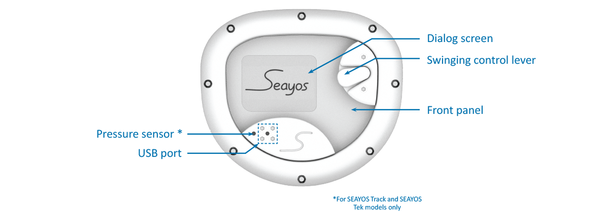
The SEAYOS Track and the SEAYOS Tek differ from the SEAYOS Back through their pressure sensor which allow three-dimensional position report (geodetic coordinates and depth), and their PC interface, enabling management and operation of collected data and transfer of coordinates to the SEAYOS. The SEAYOS Tek offers a greater depth resistance and is an enriched version of the SEAYOS Track with specific functionalities such as:
- Background maps which enable divers to locate themselves in relation to pre-identified zones
- Annotations which allow to associate a symbol with the recorded points
- multi-point guiding mode
- "tracking" function (continuous route recording system at the surface)
The three models of SEAYOS come with their diving spool equiped with 45m of cord and their USB cable. It allows to charge the device, and for the SEAYOS Track and the SEAYOS Tek, it permits the connection with the PC interface.

More info about SEAYOS operation: Here
Note: we've also designed three models specifically for professional divers. For further information, please visit our dedicated website: www.seayos-pro.com.
The SEAYOS Track and the SEAYOS Tek differ from the SEAYOS Back through their pressure sensor which allow three-dimensional position report (geodetic coordinates and depth), and their PC interface, enabling management and operation of collected data and transfer of coordinates to the SEAYOS. The SEAYOS Tek offers a greater depth resistance and is an enriched version of the SEAYOS Track with specific functionalities such as:
- Background maps which enable divers to locate themselves in relation to pre-identified zones
- Annotations which allow to associate a symbol with the recorded points
- multi-point guiding mode
- "tracking" function (continuous route recording system at the surface)
The three models of SEAYOS come with their diving spool equiped with 45m of cord and their USB cable. It allows to charge the device, and for the SEAYOS Track and the SEAYOS Tek, it permits the connection with the PC interface.

More info about SEAYOS operation: Here
Product details only serve information purposes and shall be subject to modification.
3 models, unlimited combinations of colours
Each SEAYOS is unique... like you!
Let yourself be tempted by a device that suits you and customize your SEAYOS! Choose from among a selection of colours (specific for each model of SEAYOS) the colour of each component of your SEAYOS: case (hoops, control lever, lever plate, USB port plate, USB port protector and lever plate protectors), front panel, fabric part and spool!Ranges of colours for the case and the spool:
- SEAYOS Back: neon yellow, neon green and neon orange
- SEAYOS Track : white, yellow, orange, red, light blue, dark blue, green and silver
- SEAYOS Tek : black, dark grey, light grey and emerald green
The PC interface
The PC interface (only for SEAYOS Track and SEAYOS Tek models) mainly allows to manage the dive log and
the collected data, particularly in order to exploit the information in map format.
It enables to name the registered points, to retrieve their geodetic coordinates and depth, and to automatically transfer the
data to Google Earth?
With the PC interface, you can also create a list of "favourites": these points can be transferred to the SEAYOS and be selected as destination in guiding mode.
Finally, SEAYOS PC interface manages import/export of GPX, TXT and KML file. These files are compatible with map interfaces such as DataShom or Géoportail..


